Showing posts with label cross valley. Show all posts

Sunday, March 1, 2015

Eagles & hawks in the sky, OH MY!

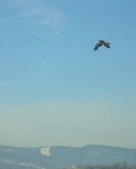
A few days ago, while we were crossing the Susquehanna River on the CrossValley (Rt 309) , 
I saw a large hawk of some sort flying alongside, but down near the water. As I scrambled to get my camera out, it, rose... flew beside us, then rose up over the car. I remember how we used to watch hawks soaring in the sky as kids with Dad. This is the only shot I got - still a YAY day! :-) 

The next day I saw an eagle in the same area. It was flying high enough to clear the cars, 
but had to climb up quickly, about 4 more feet, to soar over a truck.

Monday, March 3, 2014

Sunset location & "warm" day

frigid #weather this #winter!
3-1-2014 was a "warm-up" (high temp low 30'sdF)

(also below at the end: link to live webcam of a bald eagle nest,
not local, but in Pennsylvania. They just got snow, too.)


The sunset's on it's way back towards the right, nestling in the dip in the mountain range during the Summer, where our  local main road, the CrossValley Expressway cuts through, going North.

These sunset photos were taken from approx 5:44pm to 5:55pm.

 I love the color palette here. Interesting clouds, too!

There's a plane!!!
 Good night!

I've been watching this nest off and on the last few days. 
Once I saw the "changing of the guard! When the parents switched places.
COOL!
Here's the link, so you can see it, too:


Saturday, February 22, 2014

winter snow

 ** Beautiful snow (even if we've had TOO MUCH of it this year) **

3rd photo below is the mountain range view,
but from the other end of town, at a higher elevation.


Here's the mountain range. 
The arrow below, indicates that dip in the range we've seen often in my mountain photos. It's where the Cross Valley Expressway (Rte 309) cuts through, connecting the "Back Mountain" (Dallas, Trucksville, etc.) with Kingston (parts seen below) on the far side of the Susquehanna River. Can't see the river here.
You  see  a bit of the corner of the city of Wilkes-Barre, close to us.
(((I posted a map in an earlier post)))

A couple of winter snow shots.
PRETTY nice if I say so myself.

This is on the turnpike. I-476 
A typical scene, where the highways (and many other roads) cut through the rocky mountains,
creating interesting patterns, and lovely contrast when there's snow.


Tuesday, December 10, 2013

Winter sunset

We only got light snow in the #Wilkes-Barre, PA area Wyoming Valley#nepa this  afternoon (predicted 1-3"). Now it's breezy and the temps are dropping to the teens tonight, and a predicted high of only 26 (yikes!) tomorrow. But what a beautiful #sunset outside just a few minutes ago! 

Look how far over the sunset moved to the left!
During the Summer, the sun used to set all the way over in that dip in the mountains to the far right. That's where rte 309, the Cross Valley Expressway, cuts North towards Dallas, PA after it crossed the Susquehanna river. You can't tell here, but the altitude is much higher there - quite a climb up and through the mountains.

Saturday, August 31, 2013

Last Night's Eerie Drama

We had a storm front moving through - & some DRAMATIC cloud formations in the sky!
The start of a humid & warmer-than-usual few days for the Labor Day holiday weekend, 
with highs averaging in the mid 80s.  (this was actually night before last, Aug 29, 2013)
** Here's a panoramic view**
just as it's starting
I also show closeups left & right, below this photo.
They are all within 10 minutes: 7:40pm or so - 7:50pm.
THE SETUP
Around 7:00 we noticed the sky outside... it didn't look yellow, in fact there were bright blue areas to the Southwest (That's the left side of this photo), but it "felt" yellow.  The air itself was yellow - 
a thick dark yellow.
The wind was still - nonexistant, even though you could tell something was approaching from up the street. Eerie!
I went outside, the sun had just dipped down behind the mountain - the sun sets in the center of the panorama above, right where there's a dip in the crest, a passage through the mountain to the other side.
(ALRIGHT,... 
I can't resist ...
 imagine creepy sci-fi music playing as you read, "to the other side" above.)

Back to reality people! That "dip" in the mountains is where the local highway, the North Cross Valley Expressway, rt 309, cuts and climbs through the mountain, giving access from the major highways and the Wyoming Valley cities & riverside towns... "to the other side" (couldn't resist again), to the "Back Mountain" as it's called locally, towns of Shavertown, Trucksville, Dallas... I posted a Google map on August 14, 2013.
     I digress. So... I went outside. the sky was blue, we had just had a nice sunset with greying clouds lined with streaks of pink then purple. Nice. But,    the    air      felt     yellow.  I turned around and looked up the street (off the panoramic view, off from the right).  The sky was an entire mass of GRAY. Heavy. Then I started hearing lots of distant rumblings. You probably guessed right - those rumblings were approaching thunder & lightning. You could palpably feel the air getting thicker, then the breezes started as I ran around the yard, prepping for a storm, in case there were strong gusts.

A FEW PHOTOS OF IMPRESSIVE CLOUDS EVENT
     Then I went inside, upstairs to the window where I can get the best shots, and started shooting. 
 First was the panoramic view above.

Closer view looking LEFT: approx 7:43pm
     
Closer view looking LEFT: approx 7:49pm
Interesting how some clouds started poking up higher & higher at the top.

Closer view looking RIGHT: approx 7:43pm
 Closer view looking RIGHT: approx 7:49pm
(In this shot I zoomed back out. I wanted to catch what I could of the huge cloud at the top.)
Then the sky turned grey, almost completely cloud-covered,
as the storm arrived.
FINAL NOTE: I wish you could have been here! I'm sure you probably experienced similar weather events, so you know how powerful the visuals and feelings can get. After this, there was nothing worth recording. It was grey. there was wind. Some rain. Somewhat anti-climactic. 
But this part was really quite fun. And beautiful.
 *1 or 2 of these photos will be available at http://christina-verdgeline.artistwebsites.com in the "My Mountain" gallery.